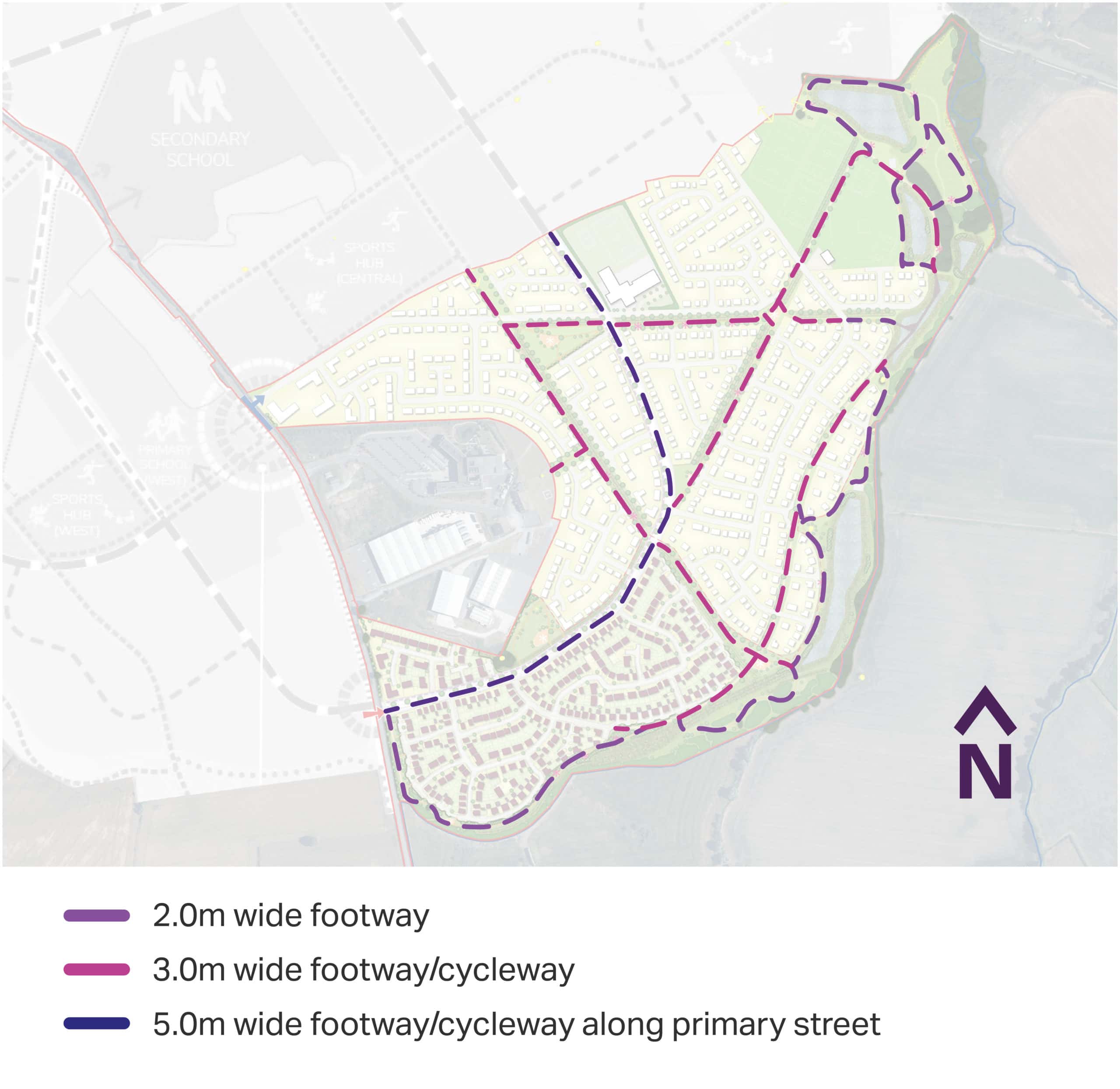
Pedestrian & Cycle Routes
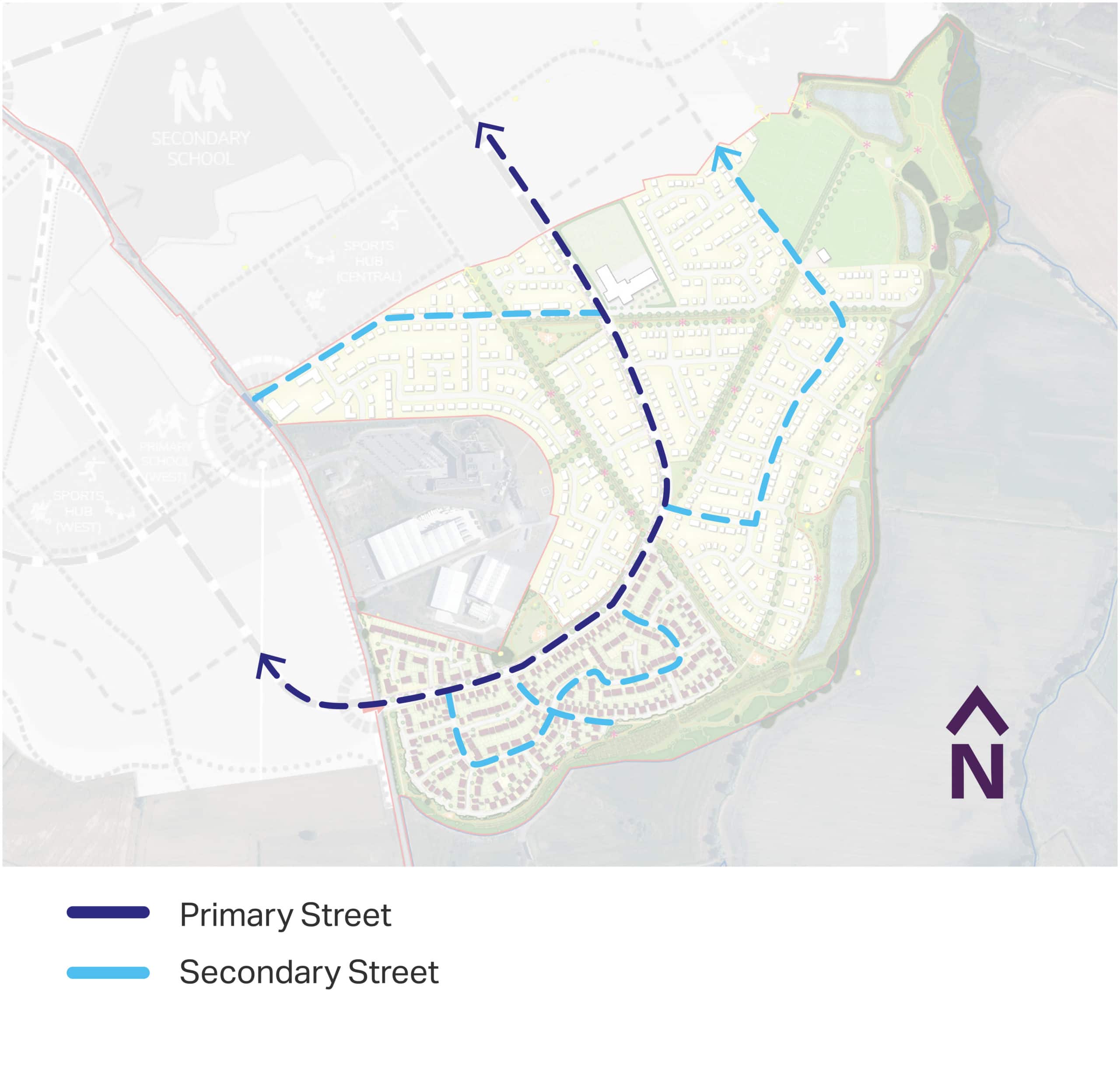
Street Hierarchy Plan
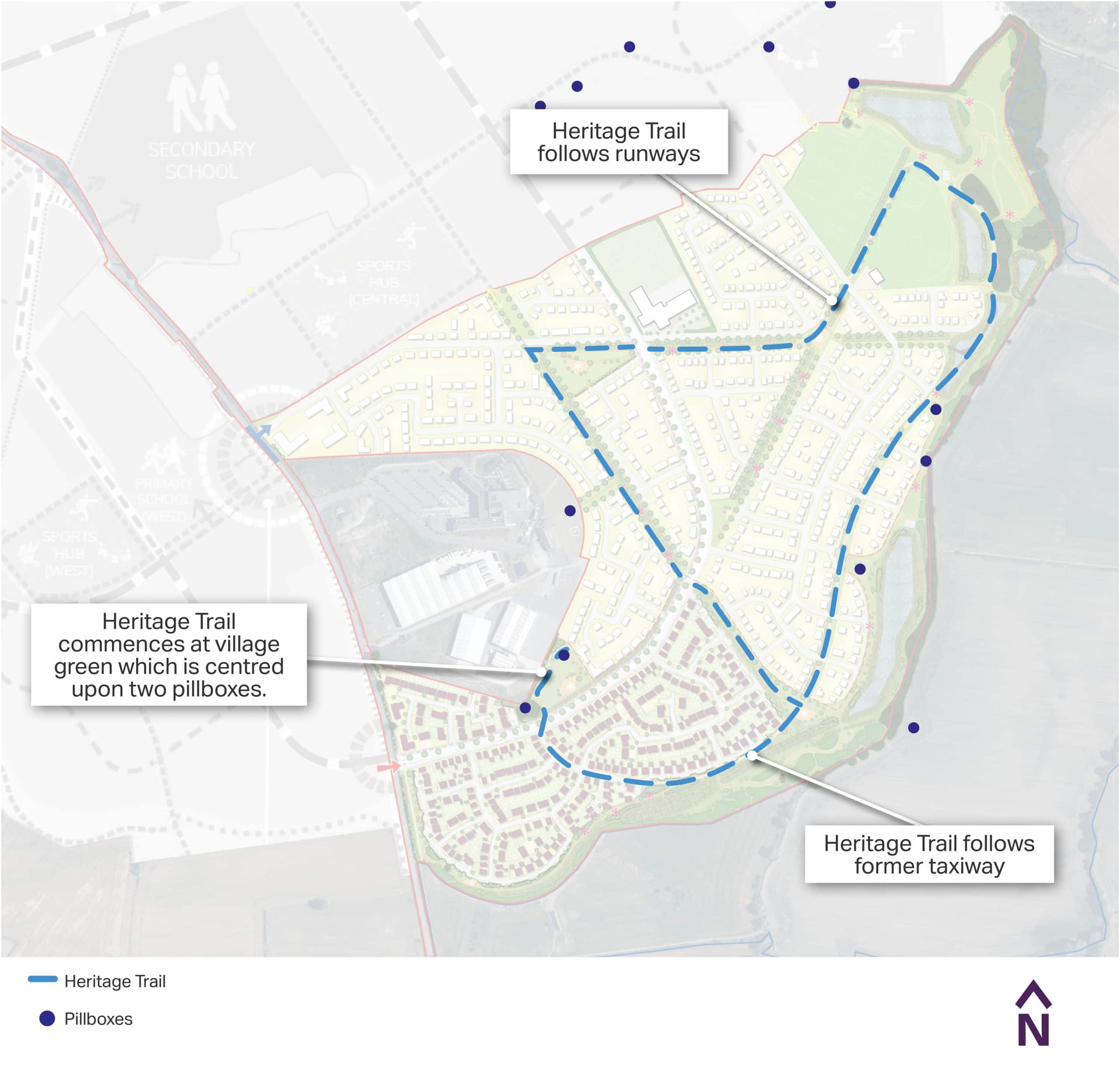
Heritage Trail
With frontage on to Tollerton Lane, vehicular access is proposed to be taken from this road. One point of access will be from the northern frontage and one will be taken from the southern frontage.
Two vehicular access points are proposed from Tollerton Lane, with a new access onto the A52 required later in the development.
The main road through the site will be designed to accommodate a bus route, and a speed limit of 20mph with appropriate traffic calming features.
A series of footways / cycleways will follow the route of the former airfield taxiway to respect the site’s World War II heritage.
A primary street will run from the southern access point and run through the heart of the site, connecting with the wider allocation site broadly halfway along the northern site boundary. It will form the main route through the site and will be designed to accommodate buses.
A series of traffic-free routes for walking and cycling (active travel) will be provided through the green spaces. The primary street will also provide a dedicated segregated footway/cycleway separated from the carriageway by a tree-lined verge, and will have priority over side roads. These pedestrian and cycle routes will connect directly with the wider allocated site. Together, these routes will help to empower the new residents to make local journeys in a more sustainable manner, like walking to the primary school or cycling to the local centre.